 vesseltracker.com
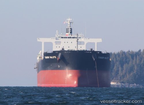
Vessel POWER LOONG IMO: 9591595, MMSI: 352898816 Bulk Carrier
UTC, 54.22673, -130.33800, course: 188, speed: 0.1
UTC, 54.22675, -130.33800, course: 187, speed: 0.1
2026-01-31 05:57:54 UTC, 54.22674, -130.33797, course: 187, speed: 0.1
Live AIS position:
UTC. Near Watson Island),
updated 2026-01-31 05:57:54 UTC.
Find the position of the vessel POWER LOONG on the map. The latter are known coordinates and path.
marine traffic ship tracker show on live map
The current position of vessel POWER LOONG is 54.22674 lat / -130.33797 lng. Updated: 2026-01-31 05:57:54 UTCCurrently sailing under the flag of Panama
POWER LOONG built in 2011 year
Deadweight:
95695 tDetails:
Last coordinates of the vessel:
UTC, 54.22674, -130.33801, course: 187, speed: 0UTC, 54.22673, -130.33800, course: 188, speed: 0.1
UTC, 54.22675, -130.33800, course: 187, speed: 0.1
2026-01-31 05:57:54 UTC, 54.22674, -130.33797, course: 187, speed: 0.1